From a geoscientific perspective, the most distinctive component of the Bükk Region Geopark comprises the Bükk Mountains—characterized by their complex folded and nappe (overthrust) structure—and the Uppony Mountains adjoining them to the north.
The rocks comprising the mountain range—which attained its complex structure during the Cretaceous—originated predominantly between the Ordovician and Jurassic periods. Triassic limestone is a defining component, though the Jurassic pillow lavas, which are remnants of deep-sea volcanism, are exceptional formations. In the foothills framing the Bükk Mountains, the characteristic constituent rocks are Tertiary and Quaternary sedimentary deposits, as well as Miocene volcanics associated with explosive eruptive activity.
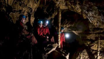
The geopark's geomorphological and hydrological character is constituted by its karstic landforms (such as karrenfields, dolines, ponors/sinkholes, and caves), the karst-hydrodynamic system developed within the carbonate rocks (which forms a strategic drinking water base), and the deep-seated thermal karst (the source of medicinal waters).
The archaeological, historical, and ethnographic heritage associated with the region's geology is extensive. It ranges from Paleolithic caves, through relics of mining and industrial history (such as mine adits, ancient bloomery furnaces, and glassworks [hutas]), and culminates in the unique "stone culture" of Bükkalja (Bükk Foothills). This latter culture is epitomized by formations like the beehive rocks (kaptárkövek), rock-hewn wine cellars, and cave dwellings.
The Geological History of the Bükk
The Bükk Mountains are predominantly composed of marine sedimentary rocks. These formations were deposited starting from the Carboniferous period of the Paleozoic Era (approximately 330–310 million years ago) and continuing until the end of the Jurassic period of the Mesozoic Era (approximately 170–150 million years ago). This near-continuous marine sedimentary sequence, deposited over a span of 140–180 million years, consists of limestone, clay that was later compressed into shale (argillaceous shale), radiolarite, dolomite, and sandstone. The distinctive visage of the Bükk is defined by its Triassic white and light-grey limestone. It is these specific terrains that host the mountain range's rich repository of karst landforms.
During the Triassic and Jurassic periods, the otherwise tranquil process of limestone deposition was interrupted by submarine volcanic activity, which was accompanied by significant crustal movements (tectonic activity). In the vicinity of Szarvaskő, accumulations of basaltic pillow lava—associated with the opening (rifting) of a deep-sea trench—as well as magmatic rocks (such as gabbro and ore-peridotite) that intruded into the sediment, are visible on the surface.
The complex tectonic structure of the Bükk Mountains—characterised by folding, overturned fold-and-imbricate structures, and large-scale overthrusts (nappe tectonics)—was established during the Cretaceous period. The Cretaceous period itself is represented only by a conglomerate that outcrops in the vicinity of Nekézseny. (This formation, however, was deposited upon the strata composing the Upponyi Mountains and notably lacks Bükk-derived pebbles.). According to some geologists, the Paleozoic-Mesozoic formations that constitute the mountain range can be categorized into two primary stratigraphic-developmental units. Others, however, differentiate a third distinct entity: the so-called Szarvaskő Nappe System.
Thus, by the Cenozoic Era, the Bükk had been "born" as a complexly structured mountain range. As a result of orogenic (mountain-building) movements, it was uplifted and became a terrestrial (dry land) environment. This landscape—initially defined by a capricious topography of synclines (fold troughs), anticlines (fold arches), and overthrust/allochthonous imbricate structures (scales) and nappes—was subsequently eroded and bevelled into a tropical peneplain by the Late Eocene. Throughout the Cenozoic, the territory of the mountain range experienced multiple episodes of subsidence (sinking) and uplift. These vertical crustal movements were accompanied by marine transgressions (sea advances) and regressions (sea retreats). In the wake of these events, new strata of limestone, clay, sand, sandstone, and gravel were deposited. A significant proportion of these younger layers has since been eroded from the Bükk's surface. The Middle Miocene marine sediments, for example, were deposited directly upon (forming an unconformity over) the Bükk's existing Triassic-Jurassic rocks.
The boundary of the Middle Miocene Sea, which transgressed (advanced) multiple times, is demarcated by the remnants of wave-cut platforms (abrasion shorelines). These vestiges are found today at elevations of 300–500 metres above sea level. From that period until the Late Miocene, rhyolitic and dacitic volcanism occurred in three distinct phases. In the wake of this activity, the entire mountain range was covered in vast masses of loose and welded (ignimbritic) rhyolite-rhyodacite tuffs and tuffites. These volcanic deposits play a significant role in the geological composition of the Bükk Foothills (Bükkalja).
The karstification of the Bükk, a process that continues to the present day, commenced as early as the Late Miocene. The formation of its contemporary hydrological network (drainage system) also began during this period. This was precipitated by the final regression (retreat) of the sea from the continuously uplifting mountain range. During its few subsequent, brief transgressions (returns), the sea inundated only the peripheries (margins) of the massif. Consequently, we encounter a rich assemblage of karst phenomena—not only across the limestone territories of the Northern and Southern Bükk, but most prominently on the surfaces of the Bükk Plateau and the Kis-fennsík (Small Plateau).