In 2017, at the initiative of four settlements – Borsodnádasd, Felsőtárkány, Répáshuta and Szomolya – and coordinated by the Bükki National Park Directorate, the Bükk Region Geopark, covering 2,817 square kilometres, was established. It encompasses one of the country’s most geologically diverse areas, including the Uppony Mountains and the Bükk Mountains. The Bükk Region Geopark lies within two counties – Heves County and Borsod-Abaúj-Zemplén County – and includes 109 settlements. With the award of the UNESCO Global Geopark title, the Bükk Region Geopark became an official member of the international geopark network in 2024, recognising the Bükk region’s exceptional geodiversity.
The objectives of the Bükk Region UNESCO Global Geopark:
- the protection of geodiversity,
- the presentation of geoheritage,
- raising awareness of values and sustainability, including, in particular, increasing local residents’ awareness of the value and significance of geological heritage.
- Beyond the appeal of geoscientific values, supporting the development of the region through sustainable geotourism, building on ecological, archaeological, ethnographic, historical, cultural and gastronomic values.
The Bükk Region UNESCO Global Geopark
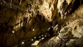
The Bükk Region Geopark covers one of the country’s most geologically diverse areas, including the folded, thrust-structured Uppony Mountains and the Bükk Mountains. In the Uppony Mountains, the oldest rocks are also exposed; these date back to the Late Ordovician period of the Paleozoic era. The bedrock of the Bükk formed during an almost continuous process of sedimentation lasting nearly 150 million years. Of international significance is the geological exposure on the northern side of Bálvány, which shows the Permian-Triassic boundary and records the geological event of the end-Permian mass extinction. The Bükk is Hungary’s most cave-rich karst region, where the subsurface contains more than 1,150 caves, many of which are of outstanding archaeological and paleontological importance. In addition to karst landforms, volcanic rocks also appear in the Bükkalja area, preserving the memory of intense Miocene volcanic eruptions.
More information: https://www.bnpi.hu/hu/bukk-videk-geopark-1
What are UNESCO Global Geoparks?
UNESCO Global Geoparks are unified, contiguous geographical areas where sites and landscapes of international geological significance are managed through an integrated concept of protection, education and sustainable development. Their bottom-up approach, which combines conservation with sustainable development and involves local communities, is becoming increasingly popular. A UNESCO Global Geopark is an international recognition that supports balance between humans and nature, and belongs to the International Geoscience and Geoparks Programme (IGGP).
European Geoparks Network
The European Geoparks Network (EGN) was founded in 2000 by four geoparks and has operated under UNESCO’s umbrella since 2001. It is a highly active network that brings together all European UNESCO Global Geoparks.
Global Geoparks Network
The GGN was originally established in 2004 as an international partnership that developed under the auspices of UNESCO. Its goal is to develop models of best practice and define quality standards for areas that integrate the protection and conservation of Earth heritage sites into regional sustainable economic development strategies.
The Bükk Region Geopark has been a member of the European and Global Geoparks Networks since 2024, and since March of this year it has borne the title of UNESCO Global Geopark of the Bükk Region.