The Bükk Region Geopark covers one of Hungary’s most complex and geologically diverse environments.
The geodiversity of the area is unique even within the Carpathian Basin. The central unit of the Geopark is formed by the Bükk, the most structurally complex mountain range of the North Hungarian Central Mountains, composed mainly of Paleozoic-Mesozoic rocks. The bedrock rocks did not form in their present location; they are related to the rocks of the Dinaric Mountains. The Paleozoic-Mesozoic rocks that make up the mountain range are found in the basement of younger basin areas connected from the northeast, east, south and southwest, at various depths of subsidence. Accordingly, these areas can be linked to the Bükk from the perspective of their geological evolution.
The structural unit bordering the mountain range from the northwest is the Bükkhát, which typically consists of the ranges of the Uppony Mountains and the Heves-Borsod Hills (an Oligocene-Miocene sandstone region), and belongs to the left-lateral strike-slip tectonic system of the Darnó Zone. In both its surface and bedrock rocks, as well as in its structural characteristics, it differs from the Bükk; its Paleozoic-Mesozoic rocks can be compared with southern Alpine and Carpathian developments.
The diversity of our Geopark is also evident from a brief summary of its geological structure and evolution. The Uppony Mountains and the Bükk expose an almost continuous sedimentary sequence of about 300 million years, from the Late Ordovician of the Paleozoic Era to the Jurassic of the Mesozoic Era. The rock composition of the area is characterized by strata that become progressively younger from north to south. The oldest formations, dating from the Paleozoic Era, are found in the Uppony Mountains. Carboniferous and Permian formations also occur in the Northern Bükk. A special geological value of the Bükk Mountains is the outcrop on the northern side of Bálvány that shows the Permian-Triassic extinction boundary. In terms of rock formation, the Triassic period was the most important in the Bükk; this was when the most characteristic limestone formations of the mountain range were created, interspersed with volcanites, marl, sandstone, silt and dolomite. The rocks formed in the Jurassic period are mostly fine-grained deep-sea sediments beside limestones; at the same time, basalt and gabbro formed as a result of submarine volcanic and subvolcanic activity. After the Jurassic period, a long sedimentary gap follows. Cretaceous sediments occur only in the Uppony Mountains, while Tertiary formations are found mainly in the southern part of the mountain range and in the hills.
In the Late Eocene, the sea advanced from the south and flooded the foot of the Bükk. Marine sedimentation continued in the Oligocene as well: with the deepening of the basement, marl was deposited, then laminated clay of euxinic facies, and later clay laid down in a more oxygen-rich environment. In the basins north and west of the Bükk, shales formed from the end of the Oligocene to the beginning of the Miocene appear at the surface. The Vajdavár region, made up of glauconitic sandstones from the end of the Oligocene and the beginning of the Miocene, is separated from the Bükk by the structure of the Darnó Zone. The rhyolitic volcanic ash fall that began at the very start of the Miocene is a marker horizon occurring almost everywhere except on the surface of the Bükk and the Uppony Mountains, which rose above the Paleogene-Neogene basins; at the surface it covers mainly the southern foothills of the Bükk, the Bükkalja. In this area, younger Miocene volcanic tuff layers (dacitic tuffs, upper rhyolitic tuffs) define the geological picture. North and northwest of the Bükk, marine and marsh formations containing 3–5 coal seams follow in a coal basin divided into two parts by the lower tuff horizon. The coal-bearing sequence is overlain by Carpathian nearshore and shore-platform abrasion formations and deeper-water shale.
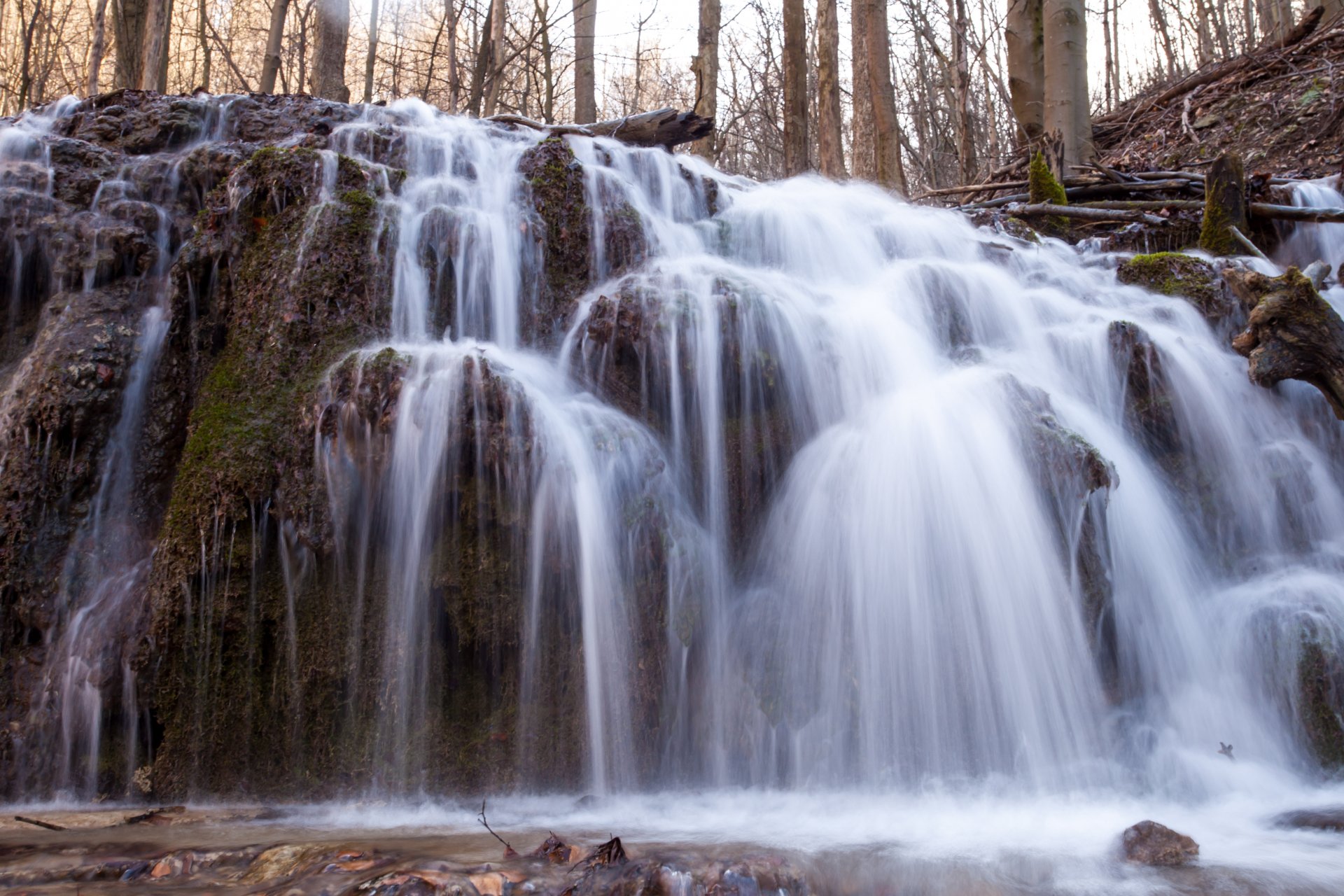
Along the southern foothills, the sinking basin was filled with inland sea, delta and marsh sediments sloping toward the Great Plain and deeply extending into it, with Pannonian lignite seams in the upper part. During the Pleistocene-Holocene, river gravel, sand and clay filled the river and stream valleys, as well as the southern foreland of the Bükk. On the southern foothills and in the foreland, blankets of loess and windblown sand formed during the Ice Age. At the same time, karstification and strong denudation were taking place in the carbonate mountain regions.
The Bükk Mountains and the Uppony Mountains belong, from a physical-geographical perspective, to the Northern Hungarian Central Mountains. Except for the Bükkhát and the Bükkalja, the winters in the mountains are long and cold, but the severity of winter is moderated by a large number of sunny days. Compared with the neighbouring lowlands and hills, spring arrives later. In late spring and early summer, precipitation generally increases, and about one-fifth of the annual average precipitation of 600–800 mm falls at that time. Summer is cool, except in the southern foreland. The varied relief significantly modifies the climate of small areas. South-facing slopes receive more sunshine; snowmelt and flowering begin earlier there, and the vegetation belts extend higher. Snow lasts longest on north-facing slopes and on the north-facing sides of karst depressions, vegetation belts descend, and cold-tolerant species are common. The effects of climate change are also being felt in the Bükk region. Precipitation is lower and more unevenly distributed, both spatially and temporally. Winter precipitation is scarce, and for more than a decade the number of snow-covered days and the thickness of the snow cover have been decreasing. Spring and early-summer rains fall suddenly and in large amounts, often causing serious damage. Temperatures are also changing. In winter, extremely cold days below -15 to -20 °C occur more frequently, while summer temperatures are rising, and days above 35 °C also occur.
The rich wildlife of the Bükk region is shaped by its climatic characteristics and varied relief.In Hungary, the mountain vegetation zones developed most clearly in the Bükk, from the dry loess steppe oak forests representing the forest-steppe zone of the southern margin to the montane beech forests dominant above 700 m. In the herbaceous layers, 1,300 plant species occur in the area, from Ice Age relict species to warm-steppe meadow species; 18 of these are known only from the Bükk Mountains. Examples include the Alpine pearlwort, tall milkwort, northern dragonhead, Hungarian feather-grass, Teleki’s flower and yellow violet. A species-rich animal world is associated with the varied geomorphology and diverse vegetation. The number of species living in the Bükk is estimated at 22,000. Valuable endemic species include Gebhardt’s blind ground beetle and subendemic butterfly species such as the mountain carpet moth and the Bükk false ringlet. The eastern Carpathian endemic blue slug lives in the northern gorge valleys. A significant part of Hungary’s bat population is linked to the caves of the Bükk. Rare bat species of the Bükk include the alpine bat, Brandt’s bat and the western barbastelle. Among birds of prey, the eastern imperial eagle and the peregrine falcon are the most valuable species.
The Bükk Region Geopark is located in two counties: Heves County and Borsod-Abaúj-Zemplén County. Both county seats are within the boundaries of the geopark. The county seat of Borsod-Abaúj-Zemplén is Miskolc, the fourth most populous city in Hungary, with a population of nearly 156,000. It is an important industrial, scientific and cultural centre. It hosts a university, research institutes, museums, exhibition venues, a theatre and other cultural facilities. Due to its cultural and historical significance, as well as its proximity to the Bükk, it is an important tourism centre. The county seat of Heves is Eger, with a population of about 53,000. It is a scientific, cultural and tourism centre with significant industry, as well as viticulture and fruit growing. Until the 1990s, the settlements of the Bükkhát belonged to the catchment area of heavy industry in Miskolc and Ózd, as well as coal mining. Since the closure of the mines and the decline of large-scale industry, local enterprises and services have employed the population. In several small settlements, unemployment is relatively high, and apart from basic infrastructure, few local services are available. In the Bükkalja, alongside industry, agriculture has played and continues to play a greater role, especially viticulture and fruit growing. The favourable landscape and climatic conditions of the area make tourism significant.